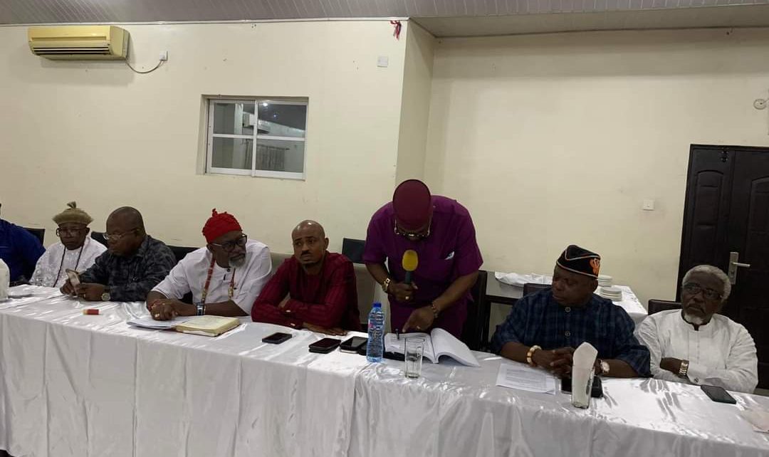
The Coalition of Aboriginal Coastal Local Government Areas of Eket, Esit Eket, ONNA, Mkpat Enin and Ikot Abasi, has called on the State Government to increase security presence in the coastal communities and ensure those behind incessant disturbances, are brought to book.
The Coalition was addressing newsmen in Uyo on Friday, after a meeting in Eket to review the mapping of the State and express gratitude to the House of Assembly, the immediate past Governor and the Surveyor General for the official map to end the perennial conflicts with some local governments over boundaries on the Atlantic coastline.
The President of the Coalition, Dr. Samuel Udonsak, who read the press statement, condemned the destruction of lives and property in Ikot Akpan Udo in Ikot Abasi; as well as Coconut Plantation and skirmishes in Esit Urua, Eket Local Government Area.
Part of the message read: “The Coalition thanks the Akwa Ibom State House of Assembly, immediate past Governor of Akwa Ibom State Deacon Udom Emmanuel and the State Surveyor General for their courageous and bold step in giving Akwa Ibom State an official map since its creation, and believes that this would put an end to the irritating, chronic and perennial conflicts emanating from lack of official boundaries between some local governments in the state especially along our Atlantic coastline.
“Akwa Ibom State has never been mapped before and we agree that this exercise is the constitutional responsibility of the state.
“The Coalition notes with disgust and utterly denunciates, and condemns the ugly violence and destruction of lives and property at Ikot Akpan Udo village in Ikot Abasi LGA, Coconut Plantation and the skirmishes at Esit Urua village, Eket LGA by Ibeno, Eastern Obolo and their Ijaw cohorts and mercenaries, against the peaceful aboriginal coastal communities.
“We call on Government to speedily restore order, bring all the perpetrators to book and increase their security presence in all the vulnerable aboriginal coastal communities.
“The coalition would like to inform the unsuspecting public, that the ownership of the entire coastline of AKS has been determined in perpetuity by various apex courts, some as far back as 1918.”
Going memory lane, the coalition’s honcho presented some historical facts and court judgments to buttress his claims:
“Eket / Esit Eket (Ekid):
The 1916 Supreme Court Judgment confirmed the ownership of the entire (Stubbs Creek) swamp land east of Qua Iboe River to Eket people. Indeed between 1914-1918 the Supreme Court siting in Calabar, the West African Court of Appeal (WACA) and the Privy Council in London had decided that the entire coastal Area from the creek known as Stubbs Creek and the sea extending from the mouth of Qua Iboe River Eastward along the sea shore to Child point (Okposo II) belongs to the Ekets, to wit: Esit Eket and Eket Local Government Areas.
” An Order/Law of the then Eastern Nigerian House of Assembly as amended in 1955 establishing Stubbs Creek’s Forest Reserve spanning from big town in Ibeno Local Government through Edo, Uquo, Akpautong, OdoroNkit, and Ntak Inyang communities in Esit Eket Local Government Area with a map duly delineated, described and surveyed with beacon stones at strategic locations by then Eastern Regional Government of Nigeria in 1929 fully established the owners of each section and village of the Stubbs Creek.
“In Suit No. HEK/108/2002 an Order of Court had expressly directed the Surveyor General of Akwa Ibom State to “produce map of Esit Eket Local Government Area and Akwa Ibom State locating the village Ine Akpautong in its proper position in Esit Eket Local Government Area”. Akwa Ibom State Government has only complied with this order by the just concluded mapping.
“ONNA
In the 1947 and 1948 cases the people of Onna obtained judgment in the Akata case (MO/48/1947 and MO/33a/1948) that established Akata as the natural outlet to the sea for ONNA people.
“The Cross River State Law No 9 of 1983 in Gazette No 33 at page A87 listed the villages of Ntafre, Iwud Ukpum, and Ine Ikwe amongs in Oniong and Nung Ndem clans; granting Oniong and Nung Ndem clans of Onna Local Government Area access to the sea.
“MKPAT ENIN
In the 1995 Judicial Commission of Inquiry Report into the Land dispute between Okoroette in Ikot Abasi Local Government Area then and Ikot Ekong, Ikot Akpaden, Ikot Obio Ndoho etc all in Mkpat Enin Local Government Area, expressly recommended that the Local Government Boundaries Commission be advised to amend the boundary between Ikot Abasi and Mkpat Enin using the plan of the land in dispute in line with the West African Court of Appeal (WACA) judgment in suit nos. C/21/41 and C/8/43 (consolidated suites between the Ibibio versus Opobo and Andoni) accordingly, the eight villages of Okoroette, Amadaka, Elile, Kampa, Okoro Mbokho, Iko, Akpabom and Atabrikang II should thus be included in Mkpat Enin Local Government Area. Only in the just concluded mapping of the State has this order been complied with.
” The 1990 case (HET/23/77) and its subsequent Appeal (2001) Ndon Ibotio and Ibotio people won its right over Iko in respect of all Ikot Udobia Land granting them access to the sea.
“IKOT ABASI
In 1941, in the celebrated Down Bellow case, at the West African Court of Appeal (WACA) (C/8/1943) gave all the land, left bank of Imo River as far down to Opobo River to Qua Iboe River to Ibibios; which today are the people of Ete.
“For the avoidance of doubt, the Ijaws, including those who have just suddenly realised that they are Ijaws and Obollo must be contented with lands donated them by our forebears, when they the Ijaws arrived in distress on our shores. For, when they arrived, they didn’t bring any land in the boats with them.
“The Coalition would like to put the Ijaws and Obollo on notice that we are not opposed to their continuous canvassing for Ijaw or Obollo State or any State of such appellation ( as they did during the 2014 National Conference) but no Ibibio aboriginal land would be part of such State. While it is our choice to stay with our Ibibio kith and kin in a united Akwa Ibom State, we do not prevent them from returning to their homeland and join their Ijaws and Obollo brothers in their State, instead of whipping false public sentiments on what does not rightly, legally and naturally belong to them.”
TheHILL reports that Dr. Udonsak was flanked by members of the group, including Chairmen of affected Local Government Areas
One of the Council bosses (Esit Eket) who doubles as the ALGON chairman in the State; Rt Hon Iniobong Robson said it was laughable that the people who are against the mapping of the State were promoting an illegal map, which past and present Governors and military administrators of the State, have denied.
He recalled that the Court had directed the Surveyor General of Akwa Ibom State to “produce map of Esit Eket Local Government Area and Akwa Ibom State, locating Ine Akpautong in Esit Eket”.
He questioned the interest of an Ijaw man who represents Andoni/Opobo Nkoro Federal Constituency in Rivers State, in the coastline communities of Akwa Ibom State, when the agitators from Eastern Obolo and Ibeno, have representatives both in the National and State Assemblies.
The Esit Eket Council Chairman said indigenes of Akwa Ibom should be worried by such a petition from who he described as “an intruder” regarding his interests against the action of the State Government.
In the meantime, the State Governor, Pastor Umo Eno, has assured that his government will not rescind the official map bill which was passed by the State House of Assembly and assented to by the immediate-past Governor; Mr. Udom Emmanuel.
Pastor Eno also advised those kicking against the official map of the State to shun actions capable of igniting unnecessary tension in any part of Akwa Ibom or get ready to face the full wrath of the law.
